The BUKE team has been hard at work these past 6 months, planning and preparing for the expedition this summer! Over the course of a short series of articles, I will provide some insight into our behind the scenes preparation. This article will discuss Guatemala more broadly and then go into detail surrounding river mapping techniques.
Background Information
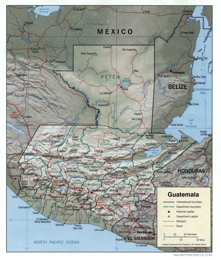
Situated in the heart of Central America bordered by Mexico, El Salvador, Honduras and Belize, and nestled between the Caribbean and Pacific, Guatemala is a country of volcanoes, mountains and forest. 31% of the country is dense rainforest, and average temperatures range from 16-38°C with an annual rainfall of 1316mm in Guatemala City, but this can double depending on time of year and longitude (due to El Niño and La Niña cycles).
Guatemalan culture has strong Mayan and Spanish influences. While Spanish is the official language, 25 different languages are spoken in the country including Kʼicheʼ, Q’eqchi’ and Kaqchikel. Food changes from region to region, but much of the cuisine includes corn, chilli and black beans. The present culture is heavily influenced by Mayan traditions, and there are many ruins spread across Guatemala including El Mirador, Aguateca and Tak’alik Ab’Aj.

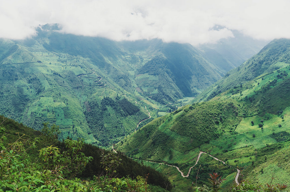
Rivers require gradient, and the Guatemalan Highlands in the southern half of the country certainly provide it. The Highlands feature several major mountain ranges including the Sierra de Chuacús and Sierra de las Minas among others, of these we have identified the Sierra de los Cuchumatanes region as of especial interest. This is the highest non-volcanic mountain range in Central America reaching heights of over 3,800m and covering an area of more than 16,000km. At this altitude much of the lowland jungle is left behind, replaced by pine trees – an environment not dissimilar to the French Alps.
Greg Schwendinger is a pioneering kayaker in the region and has written the Mayan Whitewater guidebook which details many of the rivers spread across Guatemala. The majority of rivers mentioned in the guidebook have only been paddled by Greg’s one-man team, and there is a distinct lack of complete descents in the Sierra de los Cuchumatanes region due to river difficulty and inaccessibility. As a result, the team’s immediate task was to map this region and identify likely rivers…
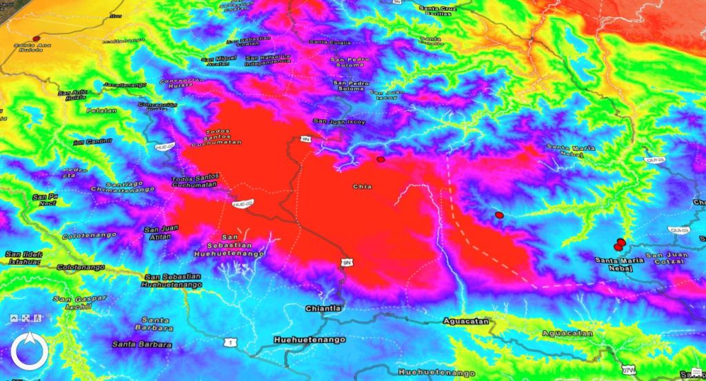
Mapping the Sierra de los Cuchumatanes
Luckily, one of my interests studying Geography at university is cartography and 3D terrain modelling. This year we have been taught how to use ArcGIS Pro, which is a commercially used mapping software. I obtained digital elevation data for the Sierra de los Cuchumatanes region, which when combined with historic satellite imagery from Google Earth allowed measurement of vegetation cover, elevation, gradient and river discharge over time.

The first thing I was able to do was create an elevation and slope model of the mountain range, highlighting the plateau and valleys running out of it. This has provided us with invaluable information regarding the likely location of rivers not clearly visible on satellite imagery, and has served as a starting point for more in-depth river mapping.

In addition, the old hands at the selection weekend provided us with a graph detailing the likelihood of flatwater, big volume and steep creeking based off of river discharge and gradient. Using a combination of ArcGIS and Google Earth, Osian and I have created river profiles which – when compared to the graph – allow us to estimate the style and grade of whitewater, including that of rivers hidden under canopy cover using the predictive software features. We have already identified several interesting rivers to investigate such as the Rio Cotzal, the rest we will surprise you with over summer…

I hope you enjoyed this article, if you’d like to keep track of our progress then check out the BUKE 2024 website or subscribe to my blog. If you’d like to support the expedition team our Go Fund Me is linked below, alternatively to support me and this blog you can use the ‘Donate’ page at the top!
BUKE website: https://www.buke2024.co.uk
